

National Geographic World Satellite Map
National Geographic World Satellite Map
1 JPG | High resolution | 6000 x 4190 pixels | 8 MB
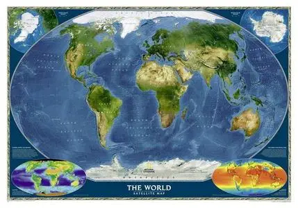
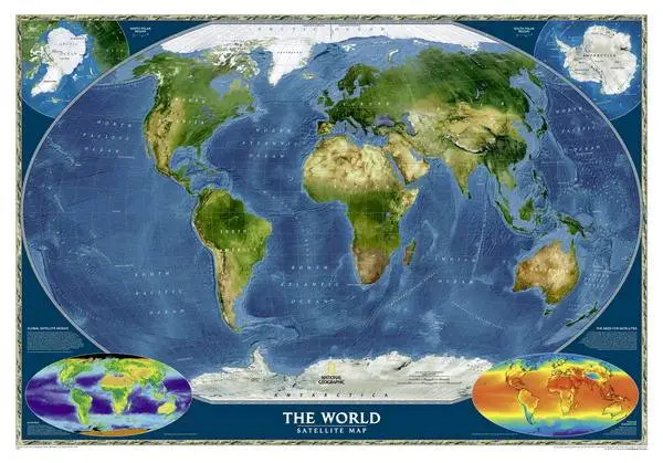
The most accurate map of the Earth's surface ever produced from satellite data. This computer-generated composite map draws from more than 500 images to give one-kilometer detail and consistent representation of natural colors.
Download
National Geographic World Satellite Map
PLEASE NO MIRRORS!
Check My Other Uploads - HERE